
Data Courtesy of U.S. Army Corps of Engineers, NWD and Grant County PUD
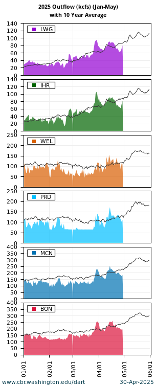
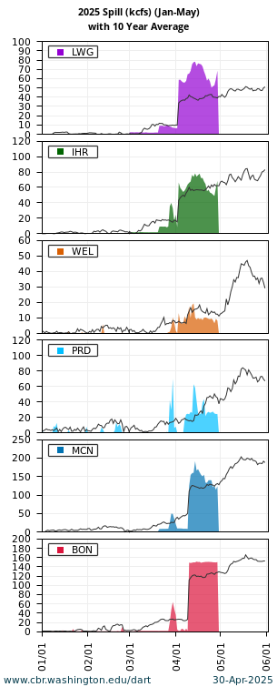
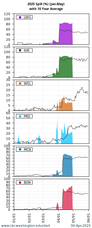
Project Conditions
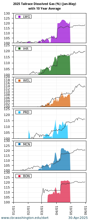
Tailrace Conditions

Last Update: June 08 2026 08:03:01.
Query Notes
- DART River Environment Metadata & Glossary
- The DART Columbia Basin River Environment "Quick Look" Summary presents current river environment with the ten year averages at Lower Granite, Ice Harbor, Wells, Priest Rapids, McNary, and Bonneville dams. Updated daily.